Standalone mapping • Google Earth • selected desktop evidence
Interactive Site Map
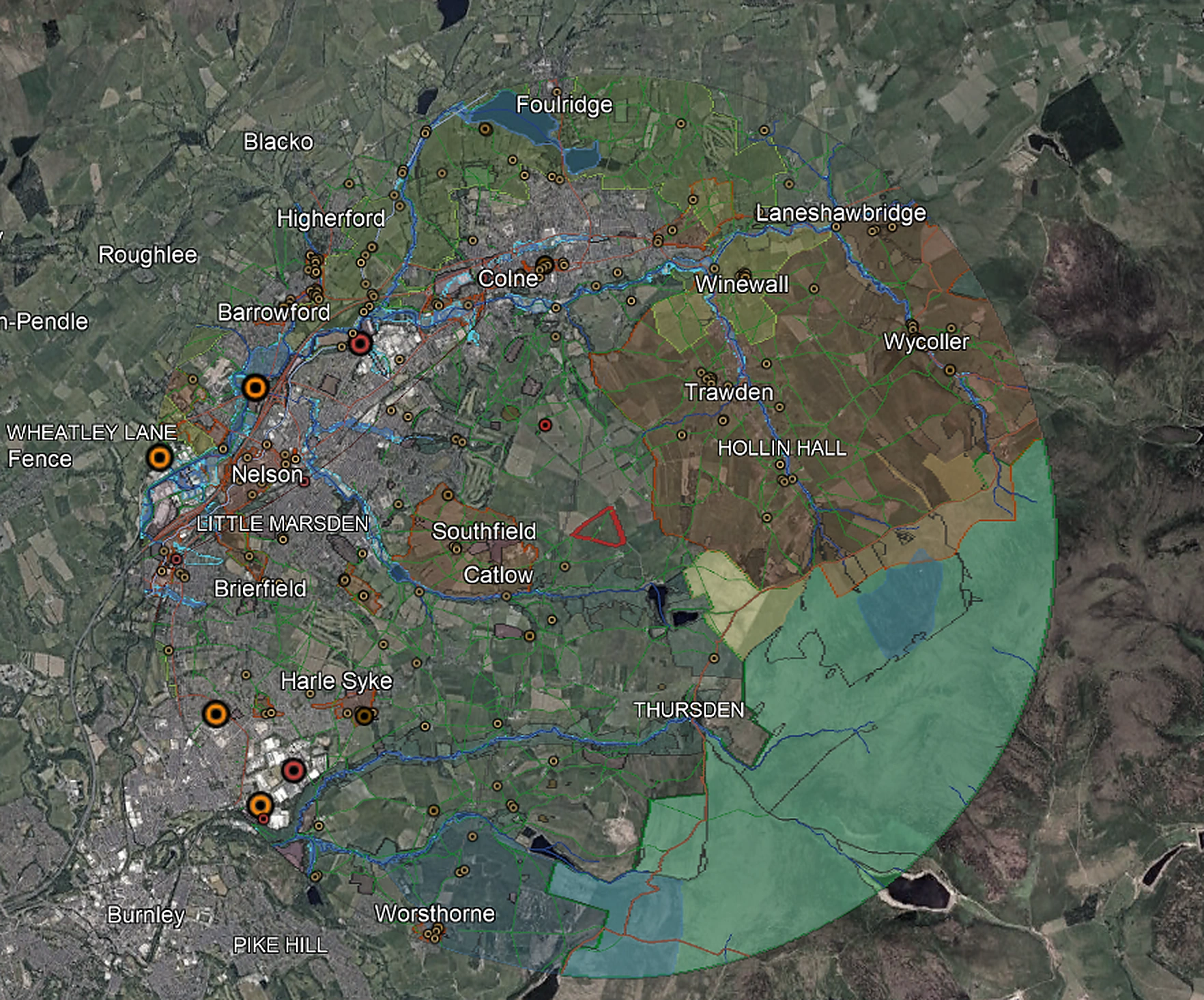
A standalone Google Earth map bringing selected environmental, planning, land, access and infrastructure context into one structured, explorable file.
It is useful where the mapped evidence itself is needed without a full written site assessment.
Format
Open the site in Google Earth, switch individual themes on and off and inspect relevant mapped relationships around the site.
Typical Map Content
Themed Layers
Selected ecology, heritage, landscape, flooding, agriculture, access and infrastructure information organised into clear folders.
Site Relationships
Mapped features can include intersections, nearest features, distances and other useful relationships where available.
Sources and Limitations
Dataset attribution, source information and desktop-data limitations travel with the map.
Applications
The Interactive Site Map can support early site review, land and developer conversations, internal project discussion and rapid spatial context before further work.
Site Assessment Option
The Early-Stage Site Assessment adds professional review, an Assessment Overview, written Constraints & Context Review and focused next steps.
Assessment ScopeScope and Limitations
The map organises selected mapped desktop evidence. It does not determine planning acceptability or development suitability.
Site surveys, technical assessments and professional interpretation may still be required.
Commissioning Process
Send the Site
Provide a site boundary, location and basic project context.
Confirm the Scope
We confirm the search area, available datasets, deliverable, fee and expected turnaround.
Map Preparation
The selected mapped datasets are exported, organised and checked for usable presentation.
Open in Google Earth
Receive the KMZ electronically and explore the site context with individual layers on or off.
Interactive Site Map Enquiries
Send a site boundary, location or short brief. We will confirm the scope, fixed fee and expected turnaround before instruction.
Please email site boundaries, plans or other attachments to hello@firstfeasibility.co.uk. See our Privacy Policy for how enquiry information is used.
Mapped desktop evidence only. The Interactive Site Map does not replace specialist assessment or professional judgement.